Advanced Aerial Data Acquisition and Visual Media for Shreveport
Louisiana's Strategic Aerial Vantage
For any advanced aerial survey requirements across Louisiana, including precise magnetometer and electromagnetic surveys, LiDAR data acquisition, and comprehensive GIS mapping, Shreveport Helicopter Charters delivers unparalleled solutions. Our capabilities leverage the inherent advantages of helicopters, such as low-altitude flight and stable hover, to achieve exceptional data fidelity. Furthermore, we specialize in high-definition aerial cinematography and photography services, providing access to cutting-edge camera platforms and even aircraft configured for door-off handheld operations to meet demanding production specifications. From detailed infrastructure inspections in Caddo Parish to expansive environmental assessments across the state, our integrated approach ensures superior data collection and visual media production tailored to your project's specific needs and objectives.
Aerial
Surveys
LiDAR, GIS Maps, FLIR, HD Video & More
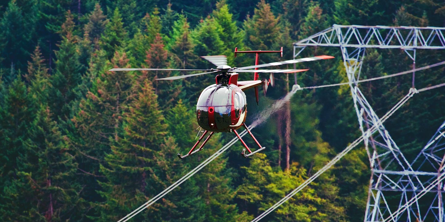
For critical infrastructure projects, including precise pipeline integrity surveys, Rights-of-Way (ROW) inspections, and comprehensive transmission line patrols throughout Louisiana, Shreveport Helicopter Charters provides optimal aerial solutions. We ensure access to the exact aircraft, equipped with specialized remote sensing and imaging technology, essential for accurate data acquisition and efficient project completion, delivering reliable insights for your operational management.
High Tech Results
The Top Pilots in Louisiana, Today's Technology... Maximum Results.
Call 1-866-826-4826 Now!
Shreveport Helicopter Charters provides the tools needed to complete your land surveys, utilizing the right equipment to provide the aerial photos that are often needed.
Effective aerial surveys transform complex Right-of-Way (ROW) and site inspections, precise topographical data acquisition, and high-resolution imaging for commercial projects into streamlined processes. Helicopters offer an unparalleled advantage for detailed observation of Louisiana's diverse terrain, facilitating meticulous pipeline leak detection, pinpointing transmission line anomalies, and capturing high-definition video and photography of extensive properties. Shreveport Helicopter Charters excels in developing bespoke photographic and advanced remote sensing operational strategies, meticulously engineered to optimize both technical precision and financial efficiency, thereby ensuring superior, actionable results for your most demanding projects across the Shreveport metropolitan area and beyond.
The distinct operational capabilities of helicopters make them the superior platform for demanding aerial surveying missions. Unlike fixed-wing aircraft, which are restricted by FAA regulations to maintain a minimum altitude of 1,000 feet above obstacles, helicopters possess the unique ability to fly at significantly lower altitudes and maintain sustained slow airspeeds or even static hover. This precision control enables unparalleled close-range inspection of critical infrastructure and hazardous environments, providing engineers and project managers in Louisiana with an otherwise unobtainable vantage point for detailed assessments and data collection.
There is no better way to conduct your visual survey, animal population counts, soil drainage analysis, ROW inspections, pipeline and transmission line inspections, and geographical surveys.
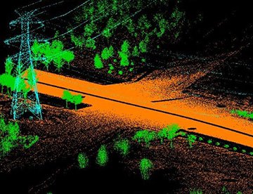
LiDAR Imaging
Light Detection and Ranging, or LiDAR, is a remote sensing method used to examine and measure Louisiana topography as well as objects, like vegetation, upon it.
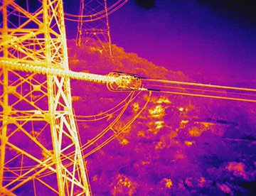
Infrared Imaging
Thermographic IR cameras are used to detect radiation in the long-infrared range of the electromagnetic spectrum and produce images of that radiation, called thermograms.
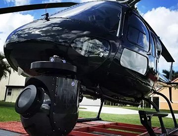
HD Video Gimbal Capture
Modern HD and 4K cameras can be mounted to helicopters, using the proper STCs, with a gimbal to stabilize photos & videos for detailed results.
Precision Aerial Cinematography and High-Resolution Videography
For expert camera work in the Shreveport Sky
Get a Fast, free QuoteShreveport Aerial Cinematography
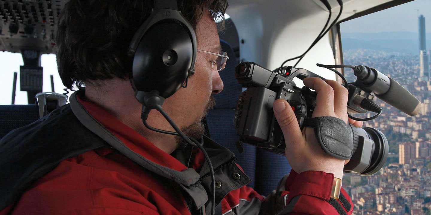
Shreveport Helicopter Charters provides unparalleled access to professional-grade aerial cinematography solutions throughout Louisiana, enabling your production to achieve stunning visual results. We facilitate custom shoots with the industry's most advanced technology, including sophisticated gyro-stabilized camera mounts such as Tyler Mounts, Wesscam, Cineflex, Pictorvision, and SpaceCam, integrated with cutting-edge specialty cameras like Cineflex HD, RED Epic, and Arri Alexa, alongside innovative 3D and experimental camera systems. Whether your project demands dynamic air-to-air sequences or precise ground-to-air shots, we comprehensively support every facet of your production goals. Our services are tailored to ensure seamless collaboration with aerial Directors of Photography and production directors, meticulously delivering the exact visual narrative required. Specializing in both still and motion photography, Shreveport Helicopter Charters is equipped to support a broad spectrum of media operations across Louisiana. This includes feature films, television series, documentaries, impactful promotional videos, high-end commercials, aerial prop deployment, rapid response for news and relief work for television networks, and extensive coverage of significant historical and major sporting events with access to a diverse fleet of specialized helicopters. This comprehensive capability ensures your creative vision is executed with technical excellence and precision, establishing us as the premier resource for aerial media production in the Shreveport region and beyond.
Call Us Today at 1-866-826-4826 for a Free Quote
Contact Us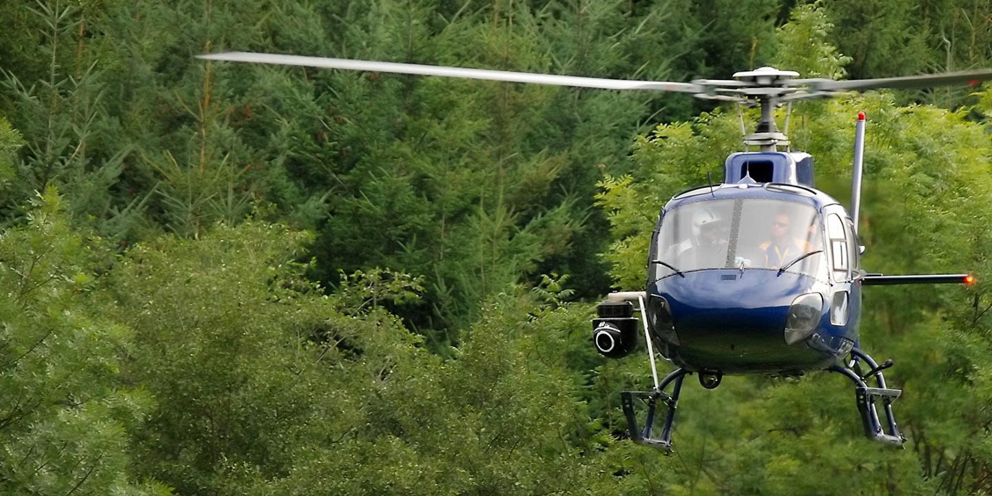
Aerial Photos
Hand-held or Mounted OpTions in Shreveport
We will help you get the right equipment for your aerial photography project! Call 1-866-826-4826 today to get a fast, free quote.
The Most Options for Photography
To truly capture Louisiana's spectacular settings and breathtaking vistas, an aerial perspective is indispensable. Shreveport Helicopter Charters provides specialized aerial photography charters meticulously designed to exceed your creative expectations, enabling you to translate your precise visual concepts into stunning photographic realities. We are dedicated to delivering cost-effective aerial imaging solutions across Louisiana. Many helicopter configurations allow for door removal, facilitating dynamic handheld photography projects. For superior stability and cinematic precision, advanced gyro-stabilized camera mount options are available, ensuring professional-grade results whether you're documenting the vibrant cityscape of Shreveport or the expansive natural beauty of the surrounding parishes for commercial, artistic, or archival purposes.
Superior Service
Every one of our customers gets a dedicated helicopter expert to assist with flight plans, tech loadouts, production logistics, project schedules, and other demands.
Over 500 Aircraft
Our network of direct air partners extends well beyond Shreveport, Louisiana. This allows us to offer a wide range of solutions for even the most sophisticated projects.
The Best Equipment
From high-tech sensors like LiDAR, FLIR, and GIS to HD cameras and movie production gimbals, we're here to make your job as easy as possible.